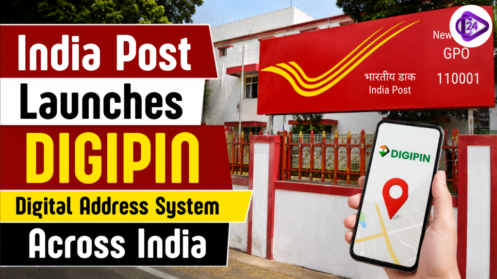
India’s postal and location infrastructure, India Post has introduced a geo-coded digital addressing system called DIGIPIN, which is a national initiative. DIGIPIN (Department of Posts, IIT Hyderabad and NRSC-ISRO) assigns a unique alphanumeric code consisting of 10 characters to each grid of 4m x 4m of the location in India. The objective of the system is to increase the accuracy of delivery, emergency response, logistics and digital governance. India Post claimed DIGIPIN would be co-used with the existing postal addresses and would not replace them. The initiative is on a larger initiative of ‘Digital Public Infrastructure (DPI)’ of India and to aid in ‘Address as a Service’ in government and private sector applications.
What is DIGIPIN and How It Will Transform India’s Address System
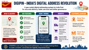
- The Department of Posts under the Ministry of Communications, has introduced a new digital addressing system known as DIGIPIN, which is geo-coded.
- The platform was designed with IIT Hyderabad and NRSC, ISRO, to provide a standardised digital address system.
- Each DIGIPIN pin corresponds to a given geographic grid (short of the 6.4 kx6.4 k one) with exact 4m x 4m geographical dimensions and latitude and longitude coordinates.
- DIGIPIN has a 10 character alphanumeric code – compared to the traditional six-digit PIN code – for very high precision localization.
- The interoperable and open-source DIGIPIN can be integrated with various digital applications and services in India, India Post said.
- This new system is intended not to take over postal addresses, but rather to complement them.
- DIGIPIN is designed to deliver greater efficiency in mail delivery particularly to areas out of the way, rural and unstructured, where addresses are not in place.
- The additional benefit is that the initiative will provide opportunities for emergency services to locate an item more quickly and accurately.
- For ecommerce and logistics businesses, there will be benefits in terms of accurate address mapping and reduced delivery errors.For ecommerce and logistics businesses, there will be benefits, such as mapping addresses accurately and reducing delivery errors.
- India Post has also launched a new platform called “Know Your DIGIPIN” that enables customers to create and validate their digital address code.
- Another platform “Know Your PIN Code” maps over 1.5 lakh PIN code zones digitally using the geo-fencing technology.
- DIGIPIN works on the Government’s Digital Public Infrastructure strategy and National Geospatial Policy initiatives.
- India Post explained that they designed the system, so it can be offline because the DIGIPIN logic and coding framework is public.
- It is possible to integrate the platform with online systems and digital governance software.
- The officials say that the technology will enhance the future-ready postal outlook of India and boost the last mile connectivity in the country as a whole.
Bangladesh Hit by Worst Measles Outbreak in Decades
Conclusion
DIGIPIN is taking India a significant forward step towards becoming a smarter and digitally connected addressing ecosystem. India Post is leveraging geospatial technology to reduce delivery errors, be present immediately when needed in response efforts, provide better service to countries and their impact on governance and logistics in urban and rural areas. Through the initiative, it also enables the adoption of a standardised and inter-operable digital addressing mechanism in India, aligning with the Digital Public Infrastructure vision. DIGIPIN could help alleviate the issues associated with addresses and enhance last mile connectivity across the country, with support from this institution (IIT Hyderabad) and the other institute (NRSC) of ISRO. The adoption is gaining pace and the system could be an important basis for future e-commerce, public services and digital governance applications in India.