Brahmaputra River system is one of the most prominent and largest river systems in Asia. It comes from the Chemayungdung Glacier, which is located near Mount Kailash of the Angsi Glacier region in southwest Tibet. It then passes through Assam and Bangladesh and finally joins the Bay of Bengal.
The river traverses two Indian states, Assam and Arunachal Pradesh, and is a key river in the northeastern region of India. Brahmaputra starts from the eastern Tibetan Plateau and flows through India and Bangladesh. The river is an ecologically rich environment, home to a variety of plants and animals, including rare and endangered species.
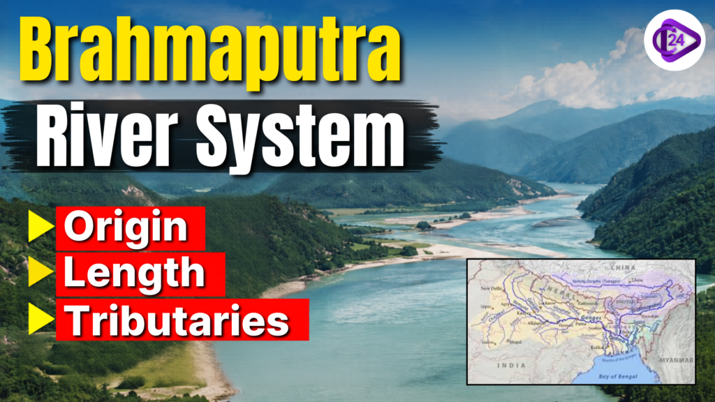
Brahmaputra River System
The Patkai Hills, the Assam hills, and the Himalayan ranges enclose the Brahmaputra River system in the east, south, and west directions, respectively. The snowfall is abundant in the Himalayan area of Sikkim and Arunachal Pradesh, making up the Brahmaputra Basin. The proportion of forest cover in these regions is also 55.48% of the Indian country and can be termed as ‘green regions’ of the country.
Designed by UNESCO as the world’s oldest inhabited river island and the largest still inhabited, Majuli Island, in Assam, is one of the most amazing features of the Brahmaputra River system. The system also possesses a proper hydropower potential of 66,065 MW, which is very valuable for the development of renewable energy resources of the river system.
The river Brahmaputra, on its journey from Kobo to Dhubri in Assam, collects a huge volume of sediment from its 20 tributaries flowing from the north bank and 13 from the south bank of the river. Most of the rainfall in the region falls during the South-West monsoon season, and 85% of the annual precipitation occurs from May to September.
Brahmaputra River System Origin
The Brahmaputra River, often called the “Son of Brahma”, originates from the Chemayungdung Glacier in southwestern Tibet. Its source lies close to the origins of the Indus and Sutlej rivers. Even though the river begins at a very high altitude, the Tsangpo section of the river has a comparatively gentle gradient. Due to this gradual slope, the river flows slowly through Tibet and forms a broad channel that remains navigable for nearly 640 kilometres.
Course of Brahmaputra Drainage System
In southern Tibet, the river is known as the Yarlung Tsangpo and flows through deep Himalayan gorges before entering India through Arunachal Pradesh, where it is called the Dihang. Near Sadiya, the Dihang turns towards the southwest and is joined by the Lohit and Dibang rivers. After this confluence, the river becomes known as the Brahmaputra in India. As it flows into Bangladesh, it is called the Jamuna and later joins the Ganga, forming the vast Sundarbans Delta before emptying into the Bay of Bengal.
| Left Bank Tributaries | Right Bank Tributaries |
| Lhasa River | Kameng River |
| Nyang River | Manas River |
| Parlung Zangbo River | Beki River |
| Lohit River | Raidak River |
| Dhanashri River | Jaldhaka River |
| Kolong River | Teesta River |
| — | Subansiri River |
Right Bank Tributaries of Brahmaputra River
The Brahmaputra River System receives support from different tributaries from the hills of the northeast region of India and the Eastern Himalaya. These tributaries pass through a variety of terrains and various states such as Assam, Meghalaya, Sikkim, and even Bhutan and Bangladesh, which have a crucial impact on the ecology, economy and culture of this region. Every river would play a unique role within the basin, whether it be through hydroelectric potential, biodiversity value, irrigation supplies or transboundary relationships. The following table describes the Brahmaputra River System’s right tributaries in terms of origin, region traversed and importance:
| Tributary Name | Origin | States/Regions Covered | Key Significance |
| Manas River | Bhutan Himalayas | Bhutan, Assam | UNESCO World Heritage region; supports rich biodiversity and wildlife sanctuaries |
| Beki River | Himalayas in Bhutan | Assam | Important for fisheries, floodplain farming, and tributary of the Manas River |
| Raidak River | Northern Bhutan | Bhutan, West Bengal, Assam | Supports irrigation and hydropower projects; joins the Brahmaputra near Dhubri |
| Jaldhaka River | Bitang Lake (Sikkim–Bhutan Border) | Sikkim, West Bengal, Bangladesh | Important transboundary river used for farming and hydroelectric projects |
| Teesta River | Pauhunri Glacier, Eastern Himalayas | Sikkim, West Bengal, Bangladesh | Major Himalayan river; important for hydropower and Indo-Bangladesh water sharing |
| Kopili River | Meghalaya Hills (Sapong Reserve) | Meghalaya, Assam | Key source for irrigation and hydroelectricity; joins Brahmaputra near Nagaon |
| Kulsi River | Khasi Hills, Meghalaya | Meghalaya, Assam | Known for river dolphins and seasonal flooding during monsoon |
| Dhansiri (South) | Patkai Hills, Eastern Himalayas | Arunachal Pradesh, Assam | Supports agriculture and biodiversity; flows through Golaghat district |
| Krishnai River | West Garo Hills, Meghalaya | Assam | Seasonal river supporting irrigation and agriculture |
| Dudhnoi River | East Garo Hills, Meghalaya | Assam | Important for local irrigation; merges with Krishnai River |
| Jinjiram River | East Garo Hills, Meghalaya | Meghalaya, Assam | Seasonal river important for flood management in Goalpara district |
| Sonkosh (Sankosh) River | Bhutan Himalayas | Bhutan, Assam | Supports irrigation and forms regional boundary areas |
Brahmaputra River System Left Bank Tributaries
Several major tributaries of the Brahmaputra River rise in the hills of Arunachal Pradesh, the Northeast and Tibet. These rivers provide an addition to the volume of water in the Brahmaputra and also help in the production of hydropower, agriculture, flood control and maintaining ecological balance. The interested reader should consult the detailed table, which includes Brahmaputra River System Left Tributaries, their heads, states/regions in which they fall and their various contribution to the river system and ecosystem. Learn more about the Brahmaputra River system.
| Tributary Name | Origin | States/Regions Covered | Key Significance |
| Lhasa River | Tibetan Plateau | Tibet | Major left-bank tributary of the Yarlung Tsangpo river system |
| Nyang River | Tibet Himalayas | Tibet | Important tributary joining the Yarlung Tsangpo in Tibet |
| Parlung Zangbo River | Eastern Tibet | Tibet | Glacier-fed tributary contributing to the Brahmaputra basin |
| Lohit River | Eastern Tibet near Kangri Karpo Range | Tibet, Arunachal Pradesh, Assam | Flows through the Mishmi Hills and joins the Siang River near the Brahmaputra Valley; Lohit Valley is known for dense forests and medicinal plants |
| Dhanashri (Dhansiri) River | Nagaland Hills | Nagaland, Assam | Supports agriculture and drainage in the Brahmaputra basin |
| Kolong River | Branch of the Brahmaputra near Hatimura, Assam | Assam | Important distributary supporting irrigation, fisheries, and local transport in Assam |
Brahmaputra River System List of Dams and Hydro Projects
| Dam / Hydroelectric Project | Location | River | Country | Status | Key Details |
| Zangmu Dam | Gyaca County, Tibet Autonomous Region | Yarlung Tsangpo (Brahmaputra) | China | Operational | First hydropower dam constructed on the Brahmaputra River with an installed capacity of 510 MW |
| Jiacha Dam | Tibet Autonomous Region | Yarlung Tsangpo | China | Under Construction | Part of China’s cascade hydropower development projects in the Brahmaputra basin |
| Dagu Dam | Tibet Autonomous Region | Yarlung Tsangpo | China | Proposed | Planned upstream hydropower project under China’s Brahmaputra river development strategy |
| Jiexu Dam | Tibet Autonomous Region | Yarlung Tsangpo | China | Proposed | Proposed run-of-the-river hydropower project in the Brahmaputra basin |
| Upper Subansiri Hydroelectric Project | Arunachal Pradesh | Subansiri River | India | Proposed / Planned | Planned hydropower project on the largest tributary of the Brahmaputra River |
| Lower Subansiri Hydroelectric Project | Assam–Arunachal Pradesh Border | Subansiri River | India | Under Construction | India’s largest hydropower project with an installed capacity of 2000 MW |
| Teesta-V Hydroelectric Project | Sikkim | Teesta River | India | Operational | Major NHPC-operated hydropower project in the Teesta basin |
| Teesta-III Dam | Sikkim | Teesta River | India | Under Construction / Partially Operational | Important hydropower project for electricity generation in Northeast India |
| Rangit Dam | Sikkim | Rangit River | India | Completed | Hydroelectric project contributing power to the northeastern electricity grid |
| Jaldhaka Hydroelectric Project | India–Bhutan Region | Jaldhaka River | India / Bhutan | Operational | Cross-border hydropower project supporting regional electricity supply |
| Kurichu Hydroelectric Project | Eastern Bhutan | Kurichu River | Bhutan | Operational | Major hydropower project contributing electricity exports to India |
| Chukha Hydroelectric Project | Chukha District | Wangchu River | Bhutan | Operational | One of Bhutan’s earliest and most important hydropower projects |
| Tala Hydroelectric Project | Chukha District | Wangchu River | Bhutan | Operational | Bhutan’s largest operational hydropower project supplying electricity to India |
| Dagachhu Hydroelectric Project | Dagana District | Dagachhu River | Bhutan | Operational | First hydropower project in Bhutan registered under the Clean Development Mechanism (CDM) |
Different Names of Brahmaputra River
The Brahmaputra River changes names along the way, based on the different languages and cultural Influences along its path. The river is known as Tsangpo or The Purifier in Tibet and passes through the countries of Bangladesh, India and China. It is given different names in each of these regions.
| Region / Country | Name of the Brahmaputra River | Key Details |
| Tibet | Tsangpo | The river is known as Tsangpo in Tibet, meaning “The Purifier” |
| China | Yarlung Zangbo | Name used for the upper course of the river flowing through the Tibetan Plateau |
| Arunachal Pradesh & Assam Valley (India) | Dihang / Siang | The river enters India through Arunachal Pradesh as the Siang or Dihang |
| Assam (India) | Brahmaputra | After joining the Lohit and Dibang rivers near Sadiya, it becomes the Brahmaputra |
| Bangladesh | Jamuna | The Brahmaputra is called the Jamuna after entering Bangladesh |
| Bangladesh | Padma | The combined waters of the Ganga and Brahmaputra are known as the Padma |
| Bangladesh | Meghna | After joining the Meghna River, the combined river system flows into the Bay of Bengal |
Cities Located on Brahmaputra River
| City | State | Location on Brahmaputra River | Key Significance |
| Pasighat | Arunachal Pradesh | Near the entry point of the Brahmaputra into India | One of the oldest towns in Arunachal Pradesh, known for scenic beauty and tourism |
| Dibrugarh | Assam | Upper Assam region along the Brahmaputra | Known as the “Tea City of India” and an important commercial center |
| Tezpur | Assam | Northern bank of the Brahmaputra | Historical and cultural city famous for its natural landscapes |
| Guwahati | Assam | Southern bank of the Brahmaputra | Largest city in Assam and a major river port, trade, and urban center |
| Goalpara | Assam | Lower Assam region along the Brahmaputra | Important town known for fertile plains and agricultural activities |
Conclusion on Brahmaputra River System
Its contributions to the economy of the country and the large number of its tributaries, ecosystems, and cultural heritage are proof of its importance in the Brahmaputra River basin. But there are many problems in this river system, which may be climate change, developmental pressure, and environmental degradation. These challenges can be tackled through coordinated action by countries, communities, and international organizations to secure the sustainable management and preservation of the Brahmaputra River System for future generations.