


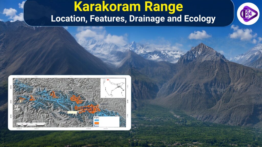
The Karakoram range forms a major part of the greater trans-Himalayan mountain system and is one of the highest and hardest mountain ranges in the world. It lies in the north-western area of the Indian subcontinent through Ladakh (India), Gilgit-Baltistan (Pakistan) and Xinjiang (China). The range is known for its snow-capped peaks, large glaciers and harsh climatic conditions. It includes some of the highest mountains in the world, such as K2 Mount Godwin-Austen).The Karakoram Range plays an important role in regional drainage systems, supports unique ecosystems, and influences the geographical processes of the Himalayan region
Karakoram Range Location and Extent
- The Karakoram Range is located in the north-western part of the Indian subcontinent, between the Pamir Mountains in the north-west and the Himalayan ranges in the south-east. It is located between the northern and north-western Pamir Mountains, and the southern (and south-eastern) ranges of the Himalaya. Several peaks of the Karakoram Range rise above 7,000 metres, with K2 reaching 8,611 metres. Range: Ladakh (India), Gilgit-Baltistan (Pakistan) and Xinjiang Province of China
- The 500 km long western Himalayan range is characterised by steep peaks and gorges.
- To the north it is bounded by the valleys of the Karakash River and Yarkand River; to the south it is bounded by that of the Indus River.
- The range provides a critical geographical connection between the Himalayas, Pamirs and Kunlun Mountains.
- The range is among the highest-altitude regions in the world, with multiple peaks more than 7,000 m (23,000 ft) in elevation.
- This range is home to K2 (Mount Godwin-Austen), the second-highest mountain in the world at 8611 m.
Major Features of Karakoram Range
The Karakoram Range is famous for its exceptional height, rugged terrain and hydrological features. The Karakoram Range has several unique geographical features that distinguish it from other Himalayan ranges.
- World’s Highest Mountain Peaks: K2 (8611 m), the second-highest mountain peak in the world, belongs to the Karakoram Range along with other higher peaks. Gasherbrum, Broad Peak
- Largest Glacier Region: Excluding the polar region, it has some of the largest glaciers in the world, such as Siachen, Baltoro, Biafo, and Hispar Glaciers.
- Rugged Mountain Terrain: It is characterised by steep slopes, sharp peaks, deep valleys and rocky terrain.
- High Altitude Region: The northernmost parts of Karakoram lie at 5,000 meters above sea level or higher, qualifying it as the second highest mountain system in the world.
- Cold and Dry: It is characterised by very low temperatures, heavy snowfall, and poor vegetation due to high altitude.
- Source of Important River: Major Rivers Indus, Shyok and Nubra are fed by glaciers of the Karakoram division.
- Rich Fauna: The region provides habitat for the snow leopard, ibex and blue sheep among others.
- Karakoram is a part of the Trans-Himalayan Mountain System, connected with several other systems like the Pamir and Kunlun.
Geology of Karakoram Range
- The Karakoram Range was formed due to the collision of the Indian Plate and Eurasian Plate, which resulted in intense tectonic activity and mountain formation.
- Wider area forming a part of the formidable Trans-Himalayan mountain regime.
- Mostly igneous and metamorphic rocks (granite, gneiss and schist)
- The region shows old magmatic activity with the presence of the Karakoram Batholith.
- It has been gently uplifted valley after valley, with folding, faulting and erosion for millennia.
- The Karakoram Fault and other tectonic structures indicate continuous geological activity in the region.
- It has a complicated geological history involving deposition, metamorphosis and volcanism in the region.
- The area is susceptible to earthquakes, landslides and rockfalls due to active tectonic movement and steep topography.
Drainage of Karakoram Range
- Most of the waters of the Karakoram Range are collected by Indus River system.
- The main drainage for this area is the Indus River, which runs along part of the southern range.
- The Shyok, Nubra, Gilgit and Hunza Rivers are the main rivers of the Karakoram.
- Most rivers of the Karakoram are glacier-fed and snow-fed, receiving water from the region’s major glaciers.
- Siachen, Baltoro, Biafo and Hispar glaciers feed the river system.
- The rivers have carved deep valleys and gorges through continuous erosion in the mountainous terrain.
- It helps the ecology as well as human habitation of the neighbouring mountainous areas through its drainage system.
Also Read
| Yamuna River System | Son River |
| Jhelum River System | Indus River System |
| Godavari River System | Indian River Systems |
| Kaveri River | Narmada River Explained |
| Krishna River System | Sutlej River System |
Importance of Karakoram Range
- The Karakoram Range also contributes to regulating the climate of the neighbouring Himalayan and Central Asian regions.
- The Karakoram is home to some of the largest glaciers, which are critical freshwater reservoirs and feed prominent river systems.
- Some unique high-altitude biodiversity of the area includes the snow leopard, Himalayan ibex, and blue sheep.
- It keeps the ecological balance of the cold desert mountain ecosystem.
- Karakoram glaciers provide some of the most critical information for understanding climate change, promoting glacier dynamics and environmental changes.
- The range serves as a natural climatic barrier to the region, affecting the sky and climate in the area.
- The landscapes, glaciers, and mountain ecosystems found here are of high scientific and conservation importance.
- Geopolitical significance of Karakoram: The Karakoram is situated at the crossroads of South Asia and Central Asia.