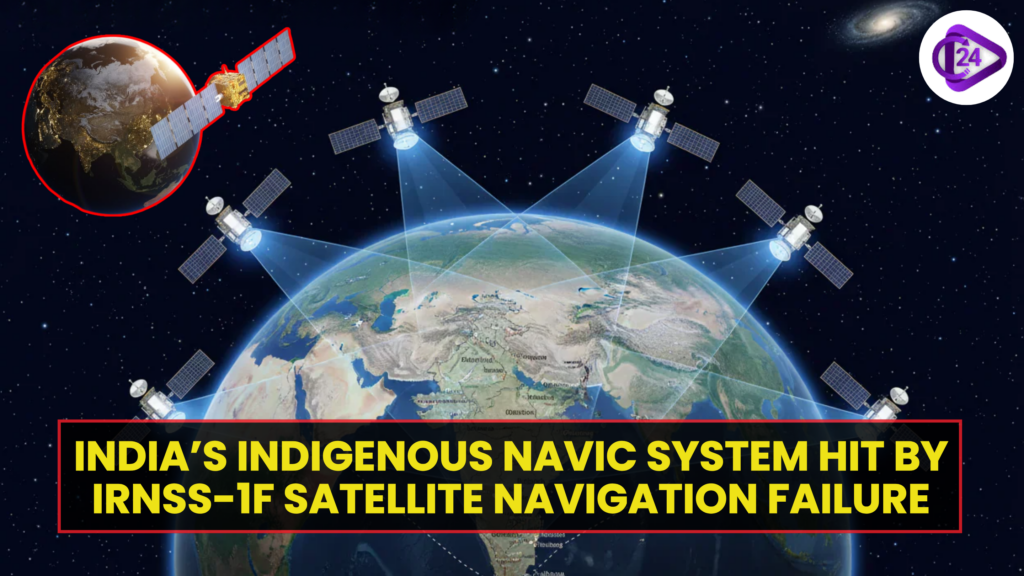
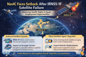
India’s indigenous satellite navigation system NavIC has encountered a major setback after the IRNSS-1F satellite ceased supporting navigation services. NavIC (Navigation with Indian Constellation) is developed by the Indian Space Research Organisation to offer accurate positioning and timing services across India and neighbouring regions. The IRNSS-1F satellite was a crucial component of this regional navigation constellation. Its failure to support navigation signals has raised concerns about the system’s operational robustness and the urgency of satellite replacements. Experts believe that maintaining a strong and fully operational constellation is vital for strategic, civilian, and commercial navigation applications.
Impact of IRNSS-1F Satellite Failure on NavIC Navigation System
- The IRNSS-1F satellite is part of India’s regional navigation constellation under the NavIC programme, which aims to provide independent and reliable positioning services for India and nearby regions.
- The satellite was launched in 2016 as part of the Indian Regional Navigation Satellite System constellation, designed to ensure accurate navigation without relying on foreign systems.
- With IRNSS-1F no longer supporting navigation services, the total number of fully operational satellites in the constellation may be reduced, potentially affecting signal strength and redundancy.
- NavIC plays an important role in strategic sectors such as defence navigation, disaster management, vehicle tracking, and maritime operations.
- The system is also expected to support civilian uses like smartphone navigation, fleet management, and mapping services across India.
- The setback highlights the importance of maintaining backup satellites and planning timely replacements to ensure uninterrupted services.
- India has been actively working to strengthen NavIC by launching replacement satellites and improving signal compatibility with modern devices.
- Despite this challenge, experts believe that India’s space programme, led by the Indian Space Research Organisation, can restore full functionality through future satellite launches and system upgrades.
Previous Year Questions on ISRO’s Satellite
| Exam | Year | Question | Answer |
| SSC CGL | 2019 | Which was India’s first satellite launched into space? (A) Rohini (B) Aryabhata (C) Bhaskara (D) INSAT | Aryabhata |
| SSC MTS | 2019 | India launched its first satellite in 1975. What was its name? (A) Rohini (B) Aryabhata (C) APPLE(D) INSAT-1A | Aryabhata |
| RRB NTPC | 2016 | In 1981, which satellite was launched by ISRO as India’s first experimental geostationary communication satellite? (A) Aryabhata (B) APPLE (C) Bhaskara-II (D) INSAT-1B | APPLE |
| SSC CHSL | 2018 | Which Indian satellite discovered evidence of water molecules on the Moon? (A) Chandrayaan-1 (B) Chandrayaan-2 (C) Mangalyaan (D) Astrosat | Chandrayaan-1 |
| RRB Group-D | 2018 | Which ISRO mission successfully entered Mars orbit in 2014? (A) Chandrayaan-1 (B) Chandrayaan-2 (C) Mangalyaan (D) Gaganyaan | Mangalyaan |
| SSC GD | 2022 | Which satellite navigation system has been developed by India? (A) Galileo (B) NavIC (C) GLONASS (D) BeiDou | NavIC |
| RRB NTPC | 2020 | Which is India’s first dedicated astronomy satellite launched by ISRO? (A) Cartosat-2 (B) GSAT-7 (C) Astrosat (D) INSAT-3D | Astrosat |
| SSC CGL | 2017 | Which satellite was the first launched by India using an Indian launch vehicle? (A) Aryabhata (B) Rohini (C) Bhaskara (D) INSAT-1A | Rohini |
| RRB ALP | 2019 | Which ISRO mission is associated with the study of the Sun? (A) Chandrayaan-1 (B) Mangalyaan (C), Astrosat (D), Aditya-L1 | Aditya-L1 |
| SSC CHSL | 2020 | Which ISRO satellite series is mainly used for mapping and earth observation? (A) Cartosat (B) INSAT (C) GSAT (D) Kalpana | Cartosat |
India’s Supreme Court Allows First-Ever Passive Euthanasia Death
Conclusion (IRNSS-1F Satellite Failure Impacts NavIC System)
The failure of the IRNSS-1F satellite highlights the challenges of maintaining a reliable navigation constellation. As part of India’s NavIC system, such setbacks underline the need for timely satellite replacements and technological upgrades. Strengthening the satellite network will be crucial to ensure uninterrupted navigation services and to maintain India’s strategic and technological independence in space-based navigation.