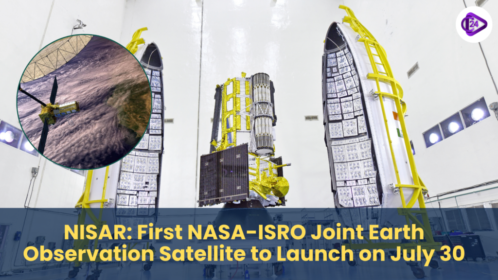
NISAR will be India and the United States first shared satellite, and it will be tested on July 30, 2025, at 5:40 p.m. at the Sriharikota station on a GSLV- F16 rocket. NASA-ISRO Synthetic Aperture Radar or NISAR as it is known is an innovative earth observation satellite that is equipped with dual-frequency radar technology of both the space agencies. Its application will include disaster monitoring, mapping of glaciers, and soil moisture analysis, in high-resolution and all-weather. Its weight of 2,392 kg is going to be injected in a sun-synchronous orbit at 743 km distance. The partnership is indicative of more than ten years of technical cooperation between ISRO and NASA s Jet Propulsion Laboratory (JPL).
Context
-
The NASA-ISRO collaboration serves as a breakthrough in international regards to cooperation in space.
-
In particular, the collaboration concerns the earth sciences and climate observation. The deployment of NISAR indicates the abilities of Indian space technologies and is in accordance with the trends on the global level to track the changes in the environment in real-time with the help of innovative satellite data.
Key Features of NISAR
Launch Details
|
Detail |
Specification |
|
Launch Date |
July 30, 2025 |
|
Time |
5:40 PM IST |
|
Launch Site |
Satish Dhawan Space Centre, Sriharikota |
|
Launch Vehicle |
GSLV-F16 |
|
Orbit |
743 km Sun-synchronous orbit, 98.4° inclination |
|
Satellite Mass |
2,392 kg |
Distinct Technicalities
-
Dual-frequency SAR:
-
NASA L-band radar
-
ISRO-S-band radar
-
NASA 12m unfurlable mesh reflector antenna is used
-
It is based on the modified variant of I3K satellite bus produced by ISRO
-
Extended-swath-and increased-resolution SweepSAR technology
-
First of its kind capability to scan a 242 km wide swathe keeping accuracy high
-
Revisit interval: Twelve days world wide
Applications of NISAR
|
Area |
Application Example |
|
Earth Surface Monitoring |
Detecting land deformation and subsidence |
|
Cryosphere Studies |
Tracking glacier movement and ice sheet changes |
|
Agriculture & Forestry |
Monitoring vegetation, soil moisture, and crop patterns |
|
Disaster Management |
Flood mapping, earthquake deformation, cyclone effects |
|
Maritime Surveillance |
Ship detection, shoreline mapping, sea ice dynamics |
|
Water Resource Management |
Mapping surface water bodies and seasonal changes |
ISRO-NASA Cooperation Background
|
Factor |
Description |
|
Collaboration Started |
Over a decade ago |
|
Main U.S. Partner |
NASA’s Jet Propulsion Laboratory (JPL), California |
|
Indian Partner |
Indian Space Research Organisation (ISRO) |
|
Joint Technology Used |
Radar systems, reflector antenna, satellite platform |
|
Goal |
To jointly develop a high-precision Earth monitoring tool |
The importance of NISAR
-
The synonym of India-U.S. strategic technological collaboration
-
Enhances the capabilities of India in remote sensing
-
Allows climate change studies, ecologically sound farming and disaster reduction
-
It improves the accessibility of data by Indian scholars and governmental institutions
-
Poses ISRO as the major actor in the world in the missions of Earth observation
Conclusion
The introduction of NISAR is history in the space cooperation agreement between India and the U.S. It can serve as a strong example of how a global way of partnerships can contribute to such a global good-driven innovation. NISAR is going to transform research on earth and practical solutions to natural and environmental challenges with applications to agriculture to climate resilience.